Investigating the seasonal dynamics of surface water over the Qinghai-Tibet Plateau using Sentinel-1 imagery and a novel gated multiscale ConvNet
We produce monthly surface water maps in Tibet plateau in 2020 by using deep learning method and Sentinel-1 image. Generally, We proposed a new gated multiscale ConvNet (GMNet) for surface water mapping based on Sentinel-1 image.The monthly surface water dynamics are captured by using the new proposed GMNet.
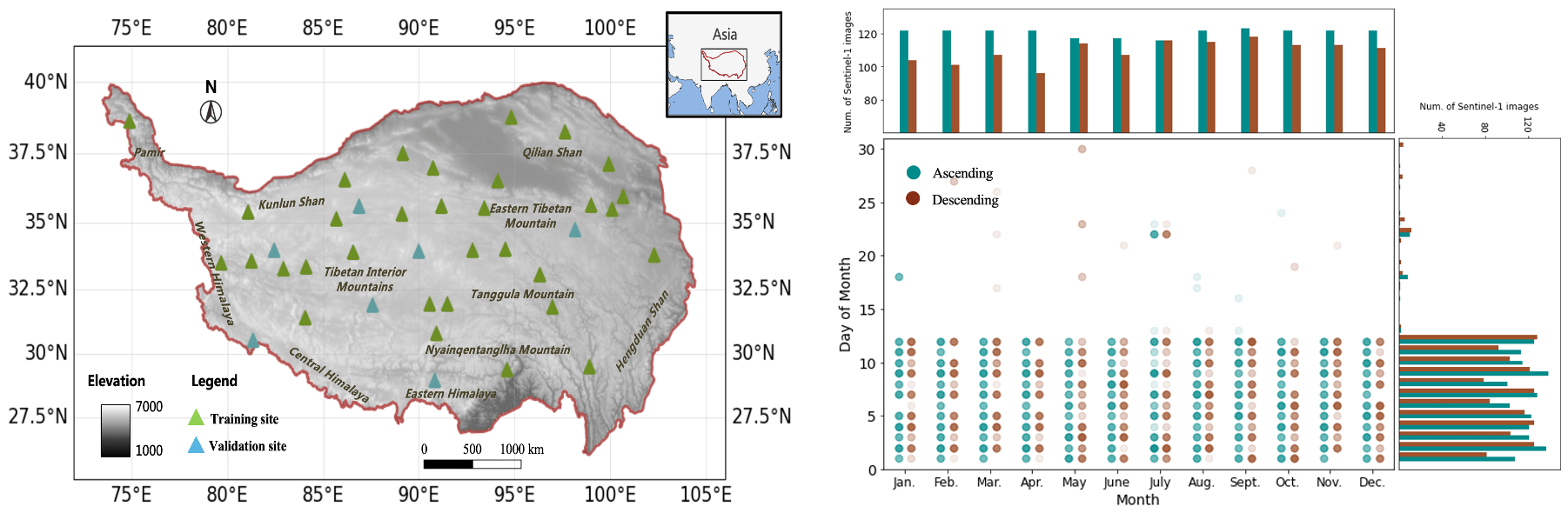
- Study area and data
- Model

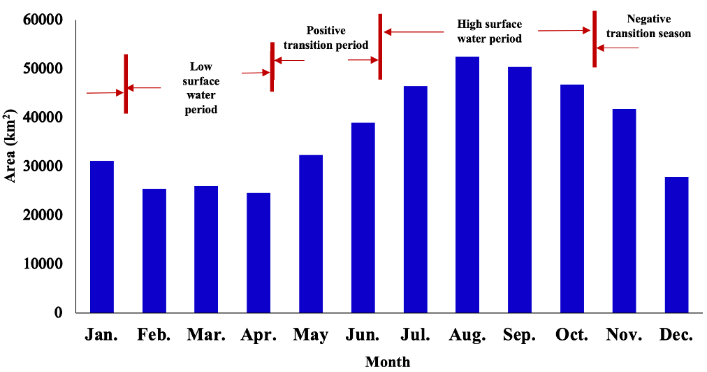
- Monthly surface water dynamic
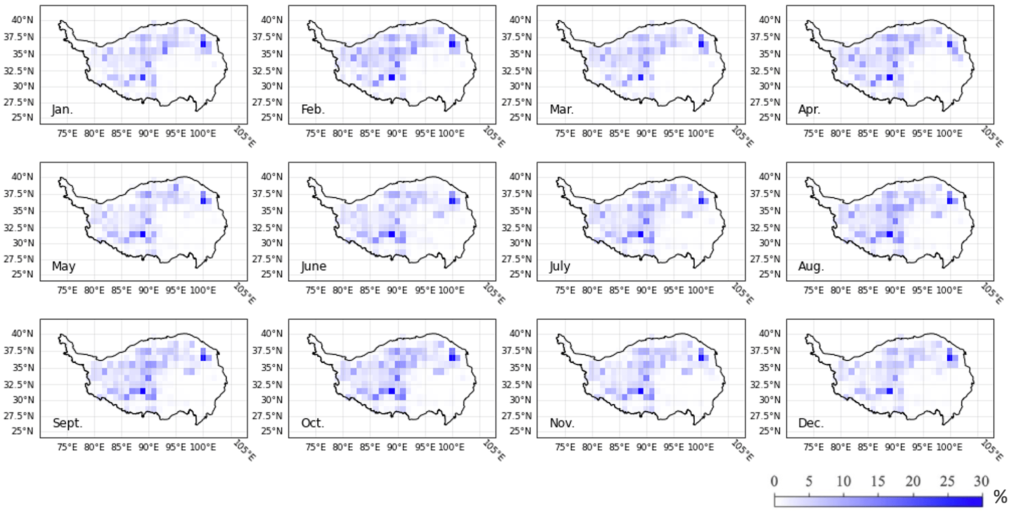
- Mothly surface water maps
- Mothly surface water trend